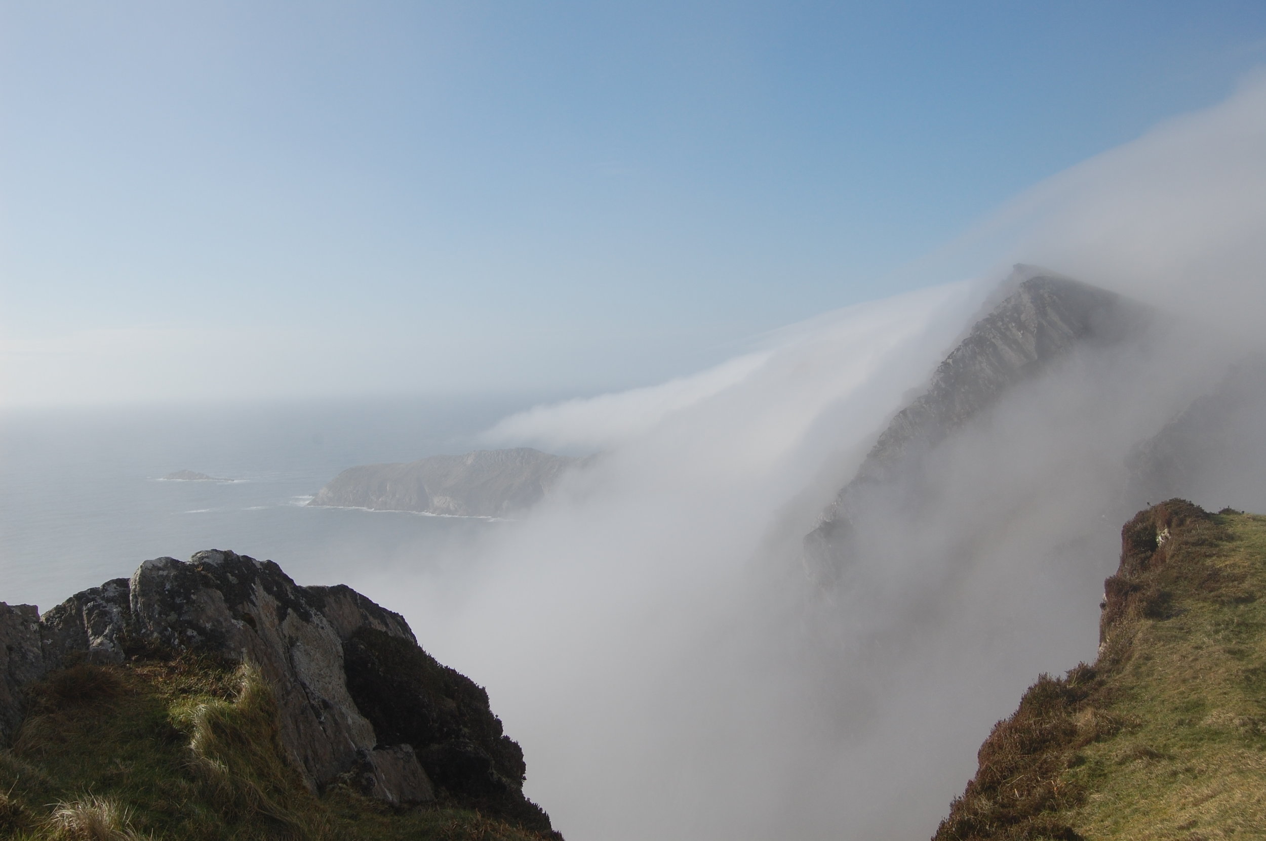
Untamed Achill

LENNY ANTONELLI takes a clifftop walk in one of the country’s wildest corners on Achill

 Irish Times, 31 March, 2012

ACHILL’S BEEN in the news so much for developer Joe McNamara’s Stonehenge imitation it’s easy to forget the wildest thing about the island isn’t the planning, but the intoxicating landscape. The most untamed terrain here is the island’s western corner, which wowed the English travel writer J Harris Stone in 1906 with its “sheer frowning precipices, no less than two thousand feet in height, and chaotically disarranged boulders of giant proportions, round which the Atlantic rollers fume and smoke”.

I set out from Keem strand, a sheltered cove with blue-green waters surrounded by steep hills, and the likely setting of Paul Henry’s painting Launching the Currach. Above the beach lie the remains of Captain Charles Boycott’s estate. When his house here was burned down, he built another on the opposite side of Croaghaun mountain. The remains of an altar where Catholic priests said secret Mass during penal times are here too.

From the car park, hike the steep 200m to the second World War lookout on the hill above. The climb is tough, but it’s the most challenging part of an otherwise moderate walk. You’ll be greeted on top by the jagged Benmore cliffs that drop into the Atlantic below.

Keem Bay was home to a major basking shark fishery between 1950 and 1975. A lookout would stalk the sharks from the headland, directing fisherman in their currachs who would sneak up on the giants of the ocean and kill them with the jab of a lance behind the head. The fishery landed more than 12,000 of the species between 1950 and 1975.

Heading away from Keem, follow the line of cliffs towards Achill Head, the island’s western tip. Some faint trails have been etched out, but they can be tricky to follow. The cliff edge overhangs in places too, so keep well back, perhaps following the intermittent sod barrier.

Perched on a clifftop above the empty Atlantic on the edge of Europe, the weather here can change in moments. As I walked along, mist rapidly rose up and over the cliffs, fogging up the valley below. Pick a clear day to tackle this one.

As you near the back of the island, the vastness of the landscape reveals itself. The cliffs below stretch a mile out to Achill Head. The empty valley lies pockmarked with lakes and, on the other side, Croaghaun drops 688m into the sea, making it three times higher than the Cliffs of Moher and one of Europe’s highest sea cliffs. The Mullet Peninsula lies to the northeast, with Clare Island, Inishturk and the mountains of Mayo and Galway to the south.

Make a gradual descent to the stone ruins on the valley floor. These are the remains of the deserted booley village of Bunowna, a summer settlement for herders who would bring their livestock here to graze. The terrain here is wet and boggy, so cross the valley and make your way back to Keem on higher ground. The isolation is splendid; just over an hour from the car park, you find yourself in one of Ireland’s wildest spots.

As I neared Keem, mist descended on the valley. Sheep appeared and quickly disappeared in the fog, and I heard ravens circling overhead. Suddenly, four birds swooped in front of me, crossing the valley, before the fog consumed them again as I made the final descent back to the beach.

Start and finish: Car park at Keem strand. To get to Achill, follow signs to Newport from either Westport or Castlebar. From Newport take the N59 to Mulranny, then take the R319 all the way to Keem at the western end of Achill, passing through the villages of Achill Sound, Keel and Dooagh.

Time: 2-3 hours.

Distance: 7km.

Map: Ordnance Survey Discovery Series, sheet 30.

Suitability: Moderate. By far the most challenging part of the walk is the initial steep climb to the clifftop.

Good boots and waterproofs are essential though, as the terrain can be very boggy, particular on the valley floor, and the weather can change quickly, with strong winds and fog posing obvious risks. Watch your footing closely on the cliffs.

Food and services: Shops, pubs and accommodation in Dooagh and Keel villages.

Further information:achilltourism.com/hillwalking

Out of the woods

A walk along Lough Mask offers rich rewards, writes LENNY ANTONELLI

Irish Times, 23 March 2012

WALKERS HEADING to the mountains of Galway and Mayo could easily overlook the isthmus between Lough Corrib and Lough Mask, but this narrow neck of land offers big rewards to those who explore it. There’s excellent walking around the villages of Cong, Clonbur and Cornamona, on lakeshore, woodland and hillside trails. On a mild March morning I set off from Cong Abbey, on the edge of the village. The mixed woodland here boasts a warren of trails and impressive trees, including redwoods and sequoias. Lord Ardilaun – a member of the Guinness family best known for donating St Stephen’s Green to the public – planted many of them, and most trails here run through his family’s old estate.

The track to Clonbur winds around the forest and through old stone tunnels before entering Clonbur Wood. Signs of large-scale tree harvesting are apparent here, but you should aim for the superb northern end of the wood.

You’ll come to a Y-junction at an information sign where the leftwards trail heads for Clonbur: take the right instead. This brings you to the limestone pavement on Lough Mask’s southern shore, the largest example of this habitat in Ireland outside the Burren. The habitat is a patchwork of shrubs, trees, wetland and open limestone pavement. A Coillte project has restored 550 hectares (1,360 acres) of woodland, removing exotic species in favour of native vegetation.

Don’t miss the superb signposted detour around White Island, where the track hugs the shores of Lough Mask. I stopped for lunch on a limestone clearing at the water’s edge. Sailors on the lake in the distance were the first people I’d seen since leaving Cong two hours before.

Leaving White Island, you can follow paths back to Cong through the same woods. You could turn right on a trail south of the R300 marked for Ard na Gaoithe Forest, a pleasant mixed woodland with trails along the shore of Lough Corrib, and a safe swimming area. But the biggest attraction lies further west. The Seanbóthar is a little-known 10km (6.2-mile) trail that follows the old road from Clonbur to Cornamona, and it’s one of the best paved trails in Ireland.

From Clonbur Wood follow signs for the village or the cemetery outside it. From Clonbur join the road to Cornamona and take the second right. When you come to a T-junction go right again. Soon the road becomes a car-free path.

The Seanbóthar winds across the southern flanks of Benlevy (also known as Mount Gable, 416m/1,365ft), crossing stone-walled fields that extend up the hillside. There are excellent views over Lough Corrib and its countless islands.

The remote hills and valleys of Joyce Country, named after a Welsh family that settled here in the 13th century, open up before you marking the transition from a landscape of forests, fields and lakes to the mountains of Connemara, with the Maamturk range lurking in the background.

To gain access to the summit of Benlevy, which offers a wonderful panorama, take the right turn before the T-junction I mentioned and heading for a townland named Ballard on the OSI map. Look out for a ladder stile beside a gate on your right that provides access to the hillside. You can then head down to Lough Coolin on the northern side of the hill.

Cong to Cornamona

Map: Ordnance Survey. Discovery Series. Sheet 38

Start: Cong village, Co Mayo. From Galway take the N84 to Headford; turn left on to the R334 to Cross village. Then take the R346 to Cong.

Finish: Cornamona, Co Galway. If a linear walk is impractical, there are plenty of opportunities for looped walks around Cong Forest, Clonbur Wood and Benlevy/Lough Coolin.

Time: Two to three hours for each leg: Cong to Clonbur, Seanbóthar and Benlevy/Lough Coolin.

Distance: Cong to Clonbur: 8km, Seanbóthar (Clonbur to Cornamona): 10km. Plus a further 2.3km of trails at Ard na Gaoithe.

Suitability: Moderate. With its well-marked trails and low hills the area is suitable for everyone, but Benlevy requires care as the terrain is steep and wet in places – navigation skills and rain gear are vital in poor weather. You can make your route as easy or as strenuous as you like, but some of the forest trails can be churned up, so good boots are crucial.

Food and services: Cong, Clonbur, Cornamona. Tourist office in Cong.

Further information: See irishtrails.ieand coillteoutdoors.ie for maps, route information and looped walk options.

The very loneliest place

LENNY ANTONELLI takes a ten hour trek through the wilderness of north Mayo.

Irish Times, 18 February, 2012

photo; jack evans

photo; jack evans

FOR CENTURIES FARMERS used the Bangor Trail to take livestock through the Nephin Beg mountains and the vast Owenduff bog, now part of Mayo’s Ballycroy National Park.

Irish naturalist Robert Lloyd Praeger described this landscape as “the very loneliest place in the country” in his 1937 book The Way That I Went.

“The hills themselves are encircled by this vast area of trackless bog,” he wrote. “I confess I find such a place not lonely or depressing but inspiring. You are thrown at the same time back upon yourself and forward against the mystery and majesty of nature.” We park beside the bothy – a stone shelter for hikers – at Letterkeen Wood, north of Newport. Many walkers begin in the town, but the trail from there is mostly on-road. From Letterkeen it’s 25km of wilderness before we’ll hit Tarmac again.

Local hiking guide Barry Murphy of Tourism Pure Walking joins us. After crossing the Altaconey River, the track skirts the edge of the huge conifer plantation. Something on the riverbank catches Murphy’s eye. “Otter droppings,” he says. “Smells like white wine.”

Many walkers loop back to Letterkeen at the end of the plantation but we carry on past Nephin Beg mountain, crossing nameless streams that feed the bog. Scots pine trees once covered this land, but about 4,000 years ago Ireland’s climate grew wetter. Heavy rainfall washed minerals down through the soil, waterlogging the land. Mosses took over, bog formed and the forest withered.

We take a detour for lunch to the Scardaun Loughs in the valley between Nephin Beg and Slieve Carr.

Heading back to the trail, we cross a ravine sheltering a lone oak tree. “The only tree on the Bangor Trail,” Murphy says. The trail skirts the edge of Slieve Carr, known by hikers as Ireland’s remotest mountain, and passes the stone ruins of old farmsteads. Ravens circle overhead.

“I’ve never seen the trail this dry,” Barry says. This provokes laughter, as we frequently plunge shin-deep into the bog. The trail is as wet as it is remote. Barry says the biggest mistake hikers could make is to try and save time by walking straight across the bog – those who built the trail kept it high enough to avoid deep bog but low enough to prevent needless climbing.

The terrain varies from rocky to extremely wet, and at points it’s hard to follow, making navigation skills vital. Timber and stone tracks are now being laid on parts. We emerge into the desolate Tarsaghaunmore valley, with the river meandering across the landscape. A small farmstead in the distance provides the first sign of modern civilisation we’ve seen for hours. Because of our late (9.30am) start, we’ll be hiking the last few miles in the dark. We put on headlamps to tackle the last low hills as the lights of Bangor Erris appear in the distance. Exhausted, we reach a road outside the village after 10 hours hiking. Tackling the Bangor Trail is a serious task, particularly in winter. It demands experience, willpower, and the right gear. But the effort expended will reward you with a breathtaking trek through one of Ireland’s last wildernesses.

Bangor Trail, Co Mayo

Map : Ordnance Survey. Discovery Series. Sheet 23

Start: Brogan Carroll bothy at Letterkeen Wood, 12km north of Newport, Co Mayo.

Leaving Newport take the N59 towards Achill and turn right after 1km at the sign for Bangor Trail/Letterkeen Loop.

Follow for 10km until Letterkeen forest, then continue to follow Bangor Trail/ Letterkeen Loop signs to the bothy.

Finish : Bangor Erris village. Leaving a second car here before the hike would be ideal, but we left bicycles in order to cycle back to Letterkeen the next day.

Route: This is not an official waymarked way, but there is some sparse marking on the trail. At grid reference F889131, make sure to turn left to follow the stream as directed by the marker, rather than following the track off to the right. Not all streams along the way have bridges, and some may be difficult to cross after heavy rainfall.

Time: 8-12 hours

Distance: 25km

Suitability: Strenuous. Physical fitness, good hiking boots and rain gear, warm clothing, plenty of food and water, hiking experience and navigation skills all essential.