Middle ground

There’s an allure on this Aran island that is hard to grasp, writes LENNY ANTONELLI

Irish Times, 25 August, 2012

DAY TRIPPERS HEAD FOR Inis Mór. Those seeking the road less travelled usually go to Inis Oirr. Few go to Inis Meáin. The island seems happy to keep it that way. The island is, of course, a Gaeltacht island. The academic AJ Hughes wrote that Inis Meáin was one of the only places he “found people who could not speak English” during his travels through the Gaeltacht in the 1990s.

After I got off the ferry, a car with a trailer full of passengers pulled up. “Want a lift?” the driver asked. I had to decline – I was here to walk.

Leaving the pier I went west above the beach, then turned on to a boreen through the labyrinth of stone walls and up to the main settlement. Dozens of five-spot burnet moths, with red spots on black wings, flew around. I headed west on the island’s main road, past JM Synge’s old cottage retreat – open to visitors during the summer – and Dún Chonchúir, a huge hillfort that I had all to myself.

It’s wise to pick up cartographer Tim Robinson’s meticulously drawn map of the islands before you go – it names every cliff, inlet and headland cut from the coast of dark limestone.

The main road climbs and ends where a path through the fields leads to Synge’s Chair, a stone shelter the writer frequented above the cliffs. I turned south here, walking between the patchwork of fields and a huge embankment of shattered limestone that had been cleared from the land.

I climbed over the rocks to find a wide pavement above the black cliffs. Here, on the island’s most desolate corner, you can engage in what Synge called “the wild pastimes of the cliff, and to become a companion of the cormorants and crows”.

Follow the coast south, but watch out: the rock can be slippery, and the cliffs overhang.

The cliffs turn to shoreline after you turn the island’s southwest corner, heading towards the windfarm that powers the island’s desalination plant. The poet Dara Beag Ó Flatharta sees the turbines as enhancing the island’s beauty, like “‘feathers in the hats of ladies at the Galway races”.

Herring gulls patrolled the coast, and the limestone was littered with their handiwork: crushed purple urchins and huge discarded crab legs. I followed a faint trail near the stone walls to avoid the wet rock. No sunshine pierced the clouds, and on days like this in limestone country, the sea, rock and sky bounce greyness off each other.

But there is plenty of colour. Past the windfarm, I turned at a walking marker on to Bóthar na gCreag, a grassy boreen surrounded by green fields splashed with the red, purple, yellow and blue of the wildflowers. I followed the track through a complex of stone walls – some taller than me – and up to the island’s other fort, Dún Fearbhai, just above the main settlement. Then it was time to head back for the ferry.

The allure of Inis Meáin can be difficult to grasp. It is, essentially, a flat grey rock. But when you leave you find yourself being drawn back to the place, almost subconsciously.

Synge found a “tawdry medley of all that is crudest in modern life” back in urban Galway after he left the island. “I have come out . . . to stroll along the edge of Galway Bay and look out in the direction of the islands,” he wrote. “The sort of yearning I feel towards those lonely rocks is indescribably acute.”

Inis Meáin

Start and finish : The pier, Inis Meáin

Distance : About 13km

Time : Four to five hours – maybe too long for a day trip, but you could get a taxi between the pier and the main settlement, and back again.

Suitability : Moderate. Avoid cliffs and remote coast in rough weather. The limestone pavement can be tough underfoot; proceed carefully near the cliffs. Bring a good map, boots, rain gear and plenty of food and water.

Map : Oileáin Arann map, produced by Tim Robinson (Folding Landscapes); OS Ireland, Discovery series, sheet 51.

Route : This is a shorter version of one in Paddy Dillon’s book Irish Coastal Walks. There are also waymarked walks that follow the boreens through the island’s interior.

Food and services : There is a shop, pub, restaurant, cafe and accommodation, but many services are seasonal.

Turkish delight

LENNY ANTONELLI takes a ramble around one of the west’s wildest islands

Irish Times, 21 July, 2012

SHEER ISOLATION SETS Inishturk apart; 14 kilometers by ferry, it’s one of our most remote outposts. Just 53 people live on the island all year round. You’ll find no sweater stores, pony-and-trap tours or interpretive centres.

The island’s western side is an expanse of rocky grassland and cliff-top that can only be explored on foot. Two looped trails leave the harbour, with it’s blue-green waters and cluster of cottages. We followed the signposts up the hill and through a gate, then went up the slope to the right for a quick lookout – sheer cliffs dropped 80 metres to the sea below us. Bring binoculars: the island’s cliffs are home to peregrine falcons, puffins, fulmars and chough.

We followed the purple trail west past lonely Lough Coolaknick (the green trail heads south here), then left it to hike to the old signal tower on the hill above – one of dozens built by the British to warn of any invasion from Napoleon’s armies in the early 19th century. At 191 metres it’s the island’s highest point, with a wide panorama of the mountains and islands of west Mayo and Connemara.

Inishturk has been inhabited on and off since 4,000 BC. After the famine, the island’s landlord, Lord Lucan, sent a gunboat with armed bailiffs to evict the islanders and knock their houses when they couldn’t pay rents. But Mayo MP Ousley Higgins fought for the islanders, and they gradually returned to rebuild their homes.

Descend back to the purple trail – marked by stone slabs across open grassland – and follow it west to a viewing point, where Atlantic waves batter huge cliffs and sharp sea stacks. The sun shone on our backs here as dozens of fulmars circled above the void, almost within touching distance.

Rather than take the purple trail inland we followed the wild cliffs heading southwest.This is the tricky part: the bumpy landscape makes it difficult to see the edge, which cuts in and out sharply. One minute I thought I was safely inland, the next I was right on the precipice.

The rough tracks here run perilously close to the overhanging edge – ignore them and follow the coast from further inland. There are steep sections there too, so be ready for a little scrambling.

We walked out to Dromore Head, then followed a stream inland past marshy Lough Namucka to a stone wall, which we followed left up a hillside. Marshy terrain must be negotiated in places here, but the ground offers a medley of wildflowers. Stay with the wall as it rejoins both marked trails and arrives at the island’s GAA pitch – cut deep into the rocky hillside – then follow the only boreen southwards.

A mining firm found gold on Inishturk in 1990, but the islanders chose not to disturb their quiet home. The Irish Times reported that the company’s geologists were “politely told not to come back to the island again”.

We took a short detour off-trail to Portdoon, a clear lagoon accessed by a steep channel through cliffs to the sea. Folklore says that Danish pirates hid their galleys here, waiting to ambush unsuspecting boats. The pirates were said to be the last people in Ireland who knew the secret of brewing a legendary beer made from heather.

Heading back towards the harbour on the trail, we stopped in the community club for tea. It was sunny enough for one last stop before the harbour: sandy Corraun beach for a quick swim. Then it was back to the ferry for the bumpy hour-long journey home, just ourselves and a couple of islanders sailing under the evening sun towards rainy mainland mountains.

Inishturk, Co Mayo

Map: OSI. Discovery Series. Sheet 37.

Getting there: O’Grady Ferries operates between Inishturk and Roonagh Pier in west Mayo every morning and evening. See clareislandferry.comfor timetables. From Westport take the R335 west to Louisburgh, go through the village and after about a quarter mile take a right turn signposted for Roonagh.

Start and finish: The harbour, Inishturk.

Distance: About 11km.

Time: A leisurely four to five hours

Suitability: Moderate.

Food and services: There is a shop, pub and post office, B&Bs that serve dinner, and self-catering options.

Further information: inishturkisland.com. Information on the marked trails at irishtrails.ie 

Priory Hall is not an exception

Priory Hall is no exception — a history of poor regulation and enforcement has left many of us living in shoddy homes, argues Lenny Antonelli

 Village magazine, May 2012

The government has launched a public consultation on building control following the high profile evacuation of the Priory Hall development in north Dublin due to fire safety defects.

But the proposed changes are nothing more than a paper exercise that will do little to boost the number of on site building inspections.

The new rules demand the submission of "certificates of compliance" confirming a project meets the legal requirements of the building regulations. Drawings showing how a building complies will also have to be lodged. But it speaks volumes that such basic measures aren't already in place.

Following Priory Hall, environment minister Phil Hogan said the fact Dublin City Council took the case to court "is a clear indication the Building Control Act is robust" (1). But if the act was robust, 240 people wouldn't have moved into a faulty building. And the government wouldn't be fixing the act six months later.

Read More

Stranger in a strange land

LENNY ANTONELLI takes a ramble through the empty lunar landscape of the east Burren

Irish Times, 7 July, 2012

DO HILLWALKERS SHUN the Burren? We tend to think the only hiking destinations around these parts are in Connemara or Mayo. Sure there’s no mountains in the Burren. But walking here is unlike anywhere in Ireland – the wildlife-rich limestone is the perfect antidote to our other soggy brown hills.

The tour buses head west towards the Cliffs of Moher, but I went east instead to 326m Slieve Carran, known for its steep cliffs. A warren of tiny boreens criss-crosses the bare limestone landscape, and there’s barely a house. Just try giving directions out here. “Never have you been in stranger country,” Irish naturalist Robert Lloyd Praeger wrote of this part of the Burren. I set out from the car park at Slieve Carran and followed the trail through a gate. Those seeking a relaxed casual ramble can take the 2.5km looped walk that circles through limestone pavement, hazel woodland and wildflower-rich grassland in a section of Burren National Park. It also visits the oratory and cave at the base of the cliff, said to have been a 7th century hermitage for St Colman Mac Duagh. With its moss-covered woodland and clear spring, it’s quite the retreat.

But I veered off the trail and up the hill left of the cliffs. This was trickier than it looked: hazel thicket blocked my path, and when I found a way through I had to scramble up a wall of rock. Soon the going got easier. Hares darted up the mountain. Early purple orchids and spring gentians were in bloom, and the strange lunar ridge of the Turloughmore hills to the east dominated my view.

I ducked under a wire fence, and over a dry stone wall that I followed northeast above the cliffs until I spotted the giant cairn on the summit to the west. Once there, I could see the mountains of Connemara across Galway Bay, and east into the Slieve Aughty hills.

I once tried to make a loop down from the summit north of the cliffs to the limestone pavement and car park below. But I was blocked by a mix of hazel thicket, farmland and steep ground, and I emerged bruised from dense scrubland. “There is a way down there, but you really have to know where you’re going,” a walker I met on top said. If you want to go back to the car park from the summit, best return the way you came. This time I ventured deeper into the grey hills, heading for a stone wall running northwest to the next hill. A herd of wild goats saw me and scurried. The going got tough as the grass vanished, and I skipped over deep fissures in the limestone. I spotted mossy carpet and thought it would make easier terrain; instead my leg plunged a metre down a crevice hidden below.

Three hundred and fifty million years ago, most of Ireland was bathed in tropical seas. The calcium-rich remains of animals such as corals, crinoids and sea urchins fell to the sea floor and compressed over the eons to form this limestone. Recent ice ages stripped surface soils and shales, smoothed the hills and scooped out the valleys. Meltwater and rain worked away at weak points in the rock to create fissures and caves.

I didn’t have time to take in the summit of Turlough Hill to the west, so I aimed north for the third hill on my route, Slieve Oughtmama. I kept following the dry stone wall – which marks the Clare-Galway border – to this final summit. The glassy surface of Galway Bay mirrored the blue sky. The landscape was divided sharply between grey hills, lime valleys and the azure bay.

I followed the stone wall down the limestone ridge towards my end point on the N67 by the coast. But the crevices were deeper than ever now, the rocks further apart, and the stone looser. A common lizard scurried under a rock. I stared deep into a dark fissure at ferns and wildflowers growing down below. This is strange country indeed.

Burren Beo Trust, burrenbeo.com

East Burren, Co Clare

Map: Ordnance Survey. Discovery Series. Sheet 52 for Slieve Carran. Sheet 51 for rest of walk.

Start: Car park at Slieve Carran, northwest of Carran village, Co Clare. Grid reference M 333 034. Heading west from Kinvara take the first left immediately after the town onto the Moy Road. Continue for about 7km, taking the first right after the crossroads. The car park is about 1km down on the right.

Finish: N67 at Abbey Hill between Kinvara and Ballyvaughan. There is also a looped walk marked from the Slieve Carran car park and Tony Kirby’s book The Burren Aran Islands: A Walking Guide also details another loop in the area.

Distance : 9km.

Time: Four hours.

Suitability : Moderate to strenuous for the full route. Involves some scrambling and hopping stone walls, and the terrain can be demanding. Watch out for hidden crevices and sudden cliffs. You will probably encounter horses and cattle en route, so give them a wide berth. Bring rain gear, warm clothes, map, compass, food, phone and fluids. Sturdy boots essential.

Food and services: Shop and pub at Bellharbour, a few miles west of my end point. More services in Kinvara, Gort, Corofin and Ballyvaughan.

Further information : Information on marked trails from Burren National Park, burrennationalpark.ie.

The quieter side

LENNY ANTONELLI finds a quieter way up Ireland’s busiest mountain

The Irish Times, 26 May, 2012

DSC_0047
DSC_0047

THERE’S MORE TO Croagh Patrick than the slog for repentance up the old track from Murrisk to redemption at the summit. If it’s solitude you seek, you could traverse the entire range of hills.

The Reek – as she’s known locally – sits dead centre of a ridge with lower hills both sides. Hiking the whole range offers one of the best walks in the west, but the traditional way up is so popular few consider it. On a clear day we followed an off-road section of the Western Way outside Westport until we reached a gap leading on to open mountainside. Ignoring the markers heading northwest, we hiked to the first spot height in the range of 456m, hopping a stone wall on the way.

The view grabs you instantly: south to isolated brown hills and valleys of Partry, Maumstrasna and Sheeffry and north over Clew bay to the mountains beyond. Croagh Patrick forms the southern end of the huge ice-carved valley that is Clew Bay, with the Nephin Beg mountains on the other side, and drumlins left by the ice forming the bay’s clustered islands.

We headed west through the heather on grassy mountainside towards the next spot height of 500m. The terrain was soft and springy – nothing like what lay ahead. In the distance, swarms of walkers scurried up and down Croagh Patrick. We joined a narrow track on the south side of the hills, heading towards them.

When we hit the main, path dozens of pilgrims were heading up and down. “Charity walk,” one told us. “You just missed Enda Kenny and Trapattoni.” Kids ran down the scree as we struggled up, our first time climbing the Reek. Soon the track got steeper, the rock looser and the crowds denser.

There was nowhere to rest. Descending walkers sent rocks hurtling towards us. “It was lovely back there,” my hiking companion said. “But this feels a bit like a building site.”

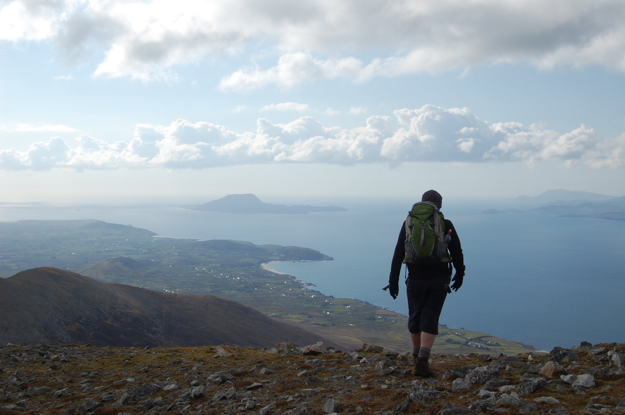
But from the summit it’s obvious why this mountain has been a site of ritual since pre-Christian times. The view from the austere peak – over Clew Bay, the mountains of Mayo and the islands of Clare and Inishturk – is one of the country’s best. Cold northerly winds blasted the peak. A man wearing just a vest began circling the chapel on the summit, but we didn’t have time to see if he went around the traditional 15 times.

Rather than head down the main track, we carried on west towards our final summit, Ben Goram. The descent on this side of Croagh Patrick is full of loose rock too, so make it a slow one.

A wall of rain descended on the Partry Mountains to the south, but the skies above us were clear blue. Soon we were back on the dry moss and heather, descending to a low pass before going up to 559m Ben Goram. A paraglider sailed through the skies over the bay.

We lingered on the hillside, but as the sun went down behind Clare Island we descended the gradual ridge northwest from the summit of Ben Goram. Watch your footing closely on the steep terrain here. We arrived back to a boreen west of Lecanvey, a good spot to leave a second car. Or you could check beforehand to see if there’s a 450 bus heading to Westport, which could leave you near the start point.

Locals in the pub afterwards were discussing whether Trapattoni had made it all the way up; he didn’t. It turns out the FAI scheduled a press conference at the visitor centre for 15 minutes after the walk started, so Trap reluctantly turned back.

I found myself thinking of the stark contrast between Croagh Patrick and the hills around it – from a gruelling cone of loose rock to green, grassy hillsides.

Just then, a woman at the bar interrupted the talk of how tough the climb is. “Ah sure, I climbed the Reek last year,” she said. “And I’m only 74.”

Croagh Patrick ridge walk, Mayo

Map : Ordnance Survey of Ireland. Discovery Series. These hills are at the intersection of four maps: 30, 31, 37, 38. If you follow the route described, you’ll need all bar 38.

Start : Take the R335 from Westport towards Louisburgh. Turn left just after the petrol station and bridge in Belclare. Then take the second right until you reach a waymarker for the Western Way at a gate on the left. Grid reference L 949 809.

Route : Take the trail until you reach a ladder on the right that brings you on to open mountain. Rather than follow markers for the Croagh Patrick Heritage Trail, aim for the first spot height of 456m. For easy navigation you could follow the stone wall that runs on the south face of these hills, marked on the OS map (31) as “Pilgrim’s Walk”.

Finish : Heading west from Westport on the R335, take the first left after Lecanvey village, then the first left again. You should find parking here. Grid reference L 876 804.

Suitability : Moderate except for the tough ascent of Croagh Patrick. Walking poles are ideal. The mountainside is often misty, so you must know how to navigate.

Time : 4-6 hours.

Distance : 10km.

Services : Westport. Food, hot showers and lockers at Croagh Patrick Visitor Centre in Murrisk. Pubs in Murrisk and Lecanvey.